Who invented GPS, when, and how?

Who invented GPS, when, and how? It was invented by a team of scientists and engineers led by Roger L. Easton and developed in the early 1960s as a part of the U.S. Navy’s efforts to improve navigation and positioning capabilities.
Imagine a world without GPS—where getting lost was a common occurrence and navigation relied heavily on maps and compasses. The development of GPS revolutionized navigation and has since become an integral part of our daily lives.
Roger L. Easton, along with his team, developed the concept of using satellites for navigation and timing purposes. This revolutionary idea paved the way for the creation of the first GPS satellite, Navigation Technology Satellites (NTS), which was launched in 1978. This marked the beginning of a new era in navigation technology.
The desire to create a system that could provide accurate positioning information anywhere on Earth was the driving force behind Easton’s work. His vision has transformed the way we navigate, allowing us to pinpoint our location with unparalleled precision.
Today, GPS is not only used for navigation but also plays a crucial role in various industries such as transportation, telecommunications, and meteorology. Its impact on society is undeniable, making it one of the most important technological advancements of the modern era.
The Birth of GPS: Revolutionizing Global Navigation
The development of GPS heralded a new era in navigation, providing accurate and reliable positioning information anywhere on Earth. This groundbreaking technology revolutionized industries, transformed everyday life, and became an indispensable tool in various fields.
The Origins of GPS
Predecessors to GPS: Early Attempts at Satellite Navigation
The concept of satellite navigation has its roots in the early 20th century, with notable developments such as the LORAN (Long Range Navigation) system during World War II. These systems laid the foundation for the eventual creation of GPS.
Military Origins: The Development of GPS Technology
The origins of GPS can be traced back to the United States Department of Defense, which recognized the strategic importance of satellite-based positioning for military operations. The need for precise and reliable navigation led to the inception of the GPS project.
The Inventors Behind GPS
Dr. Ivan Getting: Architect of the GPS Concept
Dr. Ivan Getting, a physicist and engineer, is credited with conceptualizing the idea of a satellite-based navigation system. His vision laid the groundwork for the development of GPS and its eventual implementation.
Bradford Parkinson: Pioneer in GPS Implementation
Colonel Bradford Parkinson, an aerospace engineer in the U.S. Air Force, played a crucial role in the implementation and deployment of the GPS. His leadership and expertise were instrumental in turning the concept of GPS into a reality.
Roger Easton: Key Figure in GPS Satellite Design
Roger Easton, an engineer at the Naval Research Laboratory, was instrumental in designing and developing the first generation of GPS satellites. His contributions to satellite technology paved the way for the successful launch and operation of the GPS constellation.
Timeline of GPS Invention
1950s: The Genesis of Satellite Navigation Concepts
The idea of using satellites for navigation first emerged in the 1950s, fueled by advancements in space exploration and satellite technology. Early concepts laid the groundwork for future developments in satellite-based positioning systems.
1960s: Sputnik Launch Sparks Interest in Satellite-Based Positioning
The launch of the Soviet satellite Sputnik in 1957 sparked a renewed interest in satellite-based positioning among scientists and military strategists. This event catalyzed the development of GPS and other satellite navigation systems.
1970s: U.S. Department of Defense Initiates Development of GPS
In the 1970s, the U.S. Department of Defense launched the Navstar GPS project intending to create a global navigation system for military use.
Research and development efforts focused on satellite design, signal processing, and receiver technology.
1980s: Launch of GPS Satellite Constellation Begins
The first GPS satellite was launched in 1978, marking the beginning of the deployment of the GPS constellation.
Throughout the 1980s, additional satellites were launched, gradually expanding the coverage and capabilities of the GPS system.
1990s: GPS Receivers Become Commercially Available
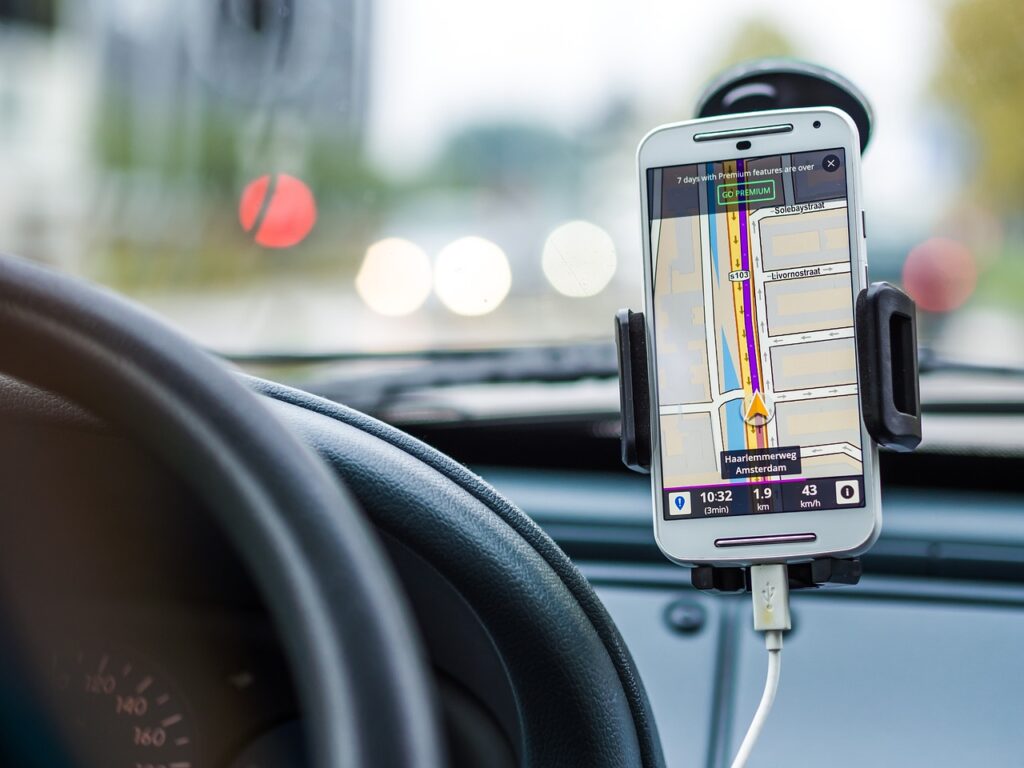
By the 1990s, GPS receivers had become commercially available to the public, paving the way for widespread adoption in various industries and applications. The commercialization of GPS technology revolutionized navigation for consumers and businesses alike.
2000s: Expansion and Improvement of GPS System
The 2000s saw significant advancements in GPS technology, including the introduction of new satellite signals, improvements in accuracy and reliability, and the development of augmentation systems to enhance performance in challenging environments.
2010s: Integration of GPS into Everyday Life
In the 2010s, GPS became an integral part of everyday life, with applications ranging from navigation and location-based services to fitness tracking and social networking.
The ubiquity of GPS-enabled devices transformed how people interacted with their surroundings and each other.
2020s: Advancements in GPS Accuracy and Reliability
As we enter the 2020s, ongoing research and development efforts continue to improve the accuracy, reliability, and resilience of the GPS system.
Advancements in satellite technology, signal processing algorithms, and receiver design promise to further enhance the performance of GPS in the years to come.
The Technical Evolution of GPS
Understanding GPS Fundamentals: How the System Works
At its core, GPS relies on a network of satellites orbiting the Earth to provide precise positioning, navigation, and timing information to users.
By triangulating signals from multiple satellites, GPS receivers can determine their location with high accuracy.
The Three Segments of GPS: Space, Control, and User
The GPS consists of three main segments: the space segment, which comprises the constellation of GPS satellites in orbit; the control segment, which consists of ground stations that monitor and manage the satellites; and the user segment, which includes GPS receivers used by individuals and organizations.
GPS Satellites: The Backbone of the Global Navigation System
The GPS satellite constellation consists of a network of 24 satellites orbiting the Earth in precise orbits.
These satellites continuously broadcast signals containing timing and positioning information, allowing GPS receivers to calculate their location based on the time it takes for signals to travel from the satellites to the receiver.
GPS Signals: Triangulating Position with Precision
GPS satellites broadcast signals on multiple frequencies, allowing GPS receivers to measure the time it takes for signals to travel from the satellites to the receiver.
By comparing the arrival times of signals from different satellites, GPS receivers can calculate their precise position in three-dimensional space.
GPS Receivers: Translating Satellite Signals into Location Data
GPS receivers are electronic devices that receive signals from GPS satellites and process them to determine the receiver’s position, velocity, and time.
Modern GPS receivers use advanced algorithms and signal processing techniques to achieve high levels of accuracy and reliability.
Augmentation Systems: Enhancing GPS Accuracy and Reliability
Augmentation systems such as WAAS (Wide Area Augmentation System) and DGPS (Differential GPS) improve the accuracy and reliability of GPS by correcting errors caused by factors such as atmospheric distortion and satellite clock drift.
These systems provide enhanced positioning capabilities for applications that require high levels of precision.
Applications of GPS Technology
Military Applications: GPS in Defense and National Security
GPS plays a crucial role in military operations, providing accurate positioning, navigation, and timing information to soldiers, vehicles, and weapons systems.
From precision-guided munitions to battlefield communications, GPS enhances situational awareness and mission effectiveness for military forces around the world.
Civilian Applications: GPS in Everyday Life
In everyday life, GPS is used in a wide range of applications, from navigation and location-based services to fitness tracking and geocaching.
GPS-enabled devices such as smartphones, tablets, and smartwatches provide users with real-time positioning information, driving directions, and location-based recommendations.
Transportation and Navigation: GPS in Automotive and Aviation
GPS has revolutionized transportation and navigation, enabling drivers, pilots, and mariners to navigate with unprecedented accuracy and reliability.
In the automotive industry, GPS navigation systems provide turn-by-turn directions, traffic updates, and points of interest information to drivers. In aviation, GPS is used for precision approach and landing procedures, airspace navigation, and flight planning.
Precision Agriculture: Optimizing Farming Practices with GPS
GPS technology is widely used in agriculture to optimize farming practices and increase crop yields.
GPS-enabled tractors, harvesters, and other farm equipment use precision agriculture techniques such as variable rate application, auto-steering, and yield mapping to maximize efficiency and reduce environmental impact.
Emergency Services: GPS in Search and Rescue Operations
GPS plays a critical role in search and rescue operations, allowing emergency responders to quickly locate and assist individuals in distress.
GPS-enabled emergency beacons and personal locator devices transmit distress signals with precise location information, enabling rescuers to deploy resources effectively and expedite rescue efforts.
Scientific Research: GPS in Geodesy and Earth Monitoring
GPS technology is used in scientific research to study Earth’s geology, atmosphere, and climate. GPS receivers are deployed in networks around the world to monitor tectonic plate motion, measure sea level rise, and track changes in Earth’s crustal deformation.
GPS data is also used to study weather patterns, monitor environmental changes, and improve our understanding of Earth’s dynamic processes.
Challenges and Future Prospects
Addressing Vulnerabilities: Protecting GPS from Jamming and Spoofing
Despite its widespread adoption and critical importance, GPS remains vulnerable to interference, jamming, and spoofing attacks that can disrupt or degrade its performance.
Addressing these vulnerabilities requires ongoing research and development efforts to develop robust and resilient GPS technologies, improve signal authentication and integrity, and deploy countermeasures to mitigate the impact of intentional and unintentional interference.
Improving Accuracy and Reliability: Next-Generation GPS Technologies
To meet the growing demand for high-precision positioning and navigation services, future GPS systems will need to improve accuracy, reliability, and availability while reducing latency, power consumption, and cost.
Next-generation GPS technologies such as multi-constellation GNSS (Global Navigation Satellite System), dual-frequency receivers, and advanced signal processing algorithms promise to enhance the performance of GPS and enable new applications and services that require centimeter-level accuracy and sub-second positioning.
Integrating GPS with Emerging Technologies: IoT, AI, and Autonomous Systems
The integration of GPS with emerging technologies such as the Internet of Things (IoT), artificial intelligence (AI), and autonomous systems presents new opportunities and challenges for navigation, positioning, and location-based services.
GPS-enabled IoT devices, AI-powered navigation systems, and autonomous vehicles rely on accurate and reliable positioning information to operate safely and efficiently in complex and dynamic environments.
Integrating GPS with these technologies requires interdisciplinary collaboration, standards development, and innovation in sensor fusion, data analytics, and machine learning to unlock the full potential of location-based intelligence and enable new applications and services that enhance our lives and shape the future of navigation.
Exploring the Potential of Multi-Constellation GNSS Systems
Multi-constellation GNSS systems such as GPS, GLONASS (Globalnaya Navigatsionnaya Sputnikovaya Sistema), Galileo, and BeiDou offer improved accuracy, availability, and reliability by combining signals from multiple satellite constellations.
These systems provide users with greater positioning accuracy, faster time to first fix, and enhanced resilience to signal blockage and interference.
Exploring the potential of multi-constellation GNSS systems requires collaboration and interoperability among satellite operators, receiver manufacturers, and service providers to ensure seamless integration and widespread adoption of multi-constellation GNSS technologies.
Conclusion
The development and deployment of GPS have transformed the way we navigate, explore, and interact with the world around us.
From military operations and transportation to agriculture, emergency services, and outdoor recreation, GPS has become an indispensable tool that enhances safety, efficiency, and productivity across various industries and applications.
The enduring legacy of GPS is a testament to the vision, dedication, and innovation of the engineers, scientists, and policymakers who contributed to its development and deployment.
As we look to the future, GPS will continue to play a central role in shaping the way we navigate, communicate, and interact with our environment.
With advancements in satellite technology, receiver design, and signal processing algorithms, GPS will become more accurate, reliable, and accessible, enabling new applications and services that enhance our lives and drive innovation in navigation, positioning, and location-based intelligence.
As we embark on this journey of exploration and discovery, GPS will guide us on our quest to navigate the world with precision, confidence, and purpose.


